|
CHILE NAVY WEATHER SERVICE
(SERVIMET) |
|
web version designed for
mariners and internet users with low bandwidth access |
|
vea los productos
disponibles en castellano |
|
1 |
Warning bulletins (Special
Weather, Gale Winds, Storms, Swell-Surge) |
|
2 |
Surface charts
and satellite images broadcasting schedules |
|
3 |
Marine
weather forecasts
(.txt) |
|
4 |
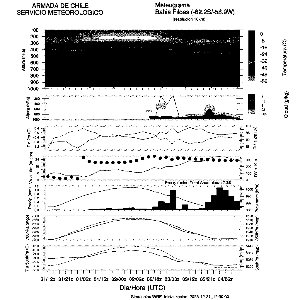
GFS, NWW3, WRF models (charts, metgrams,
soundings) |
|
5 |
Real
time weather data |
|
6 |
Sea
ice and modelling |
|
7 |
Contact Points |
|
8 |
Links of interest |
1.- Warnings
|
Iquique Meteorological Centre |
Valparaiso Meteorological Centre |
Talcahuano Meteorological Centre |
Puerto Montt Meteorological Centre |
Punta Arenas Meteorological Centre |
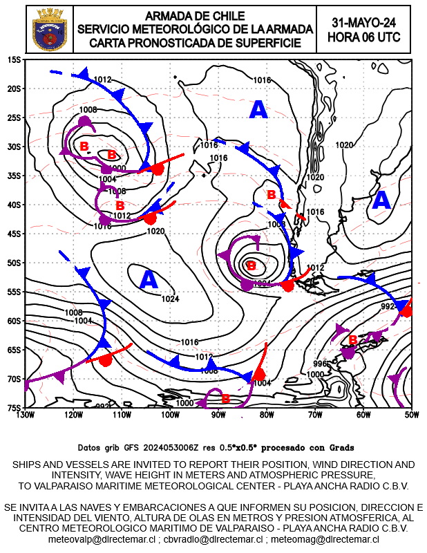
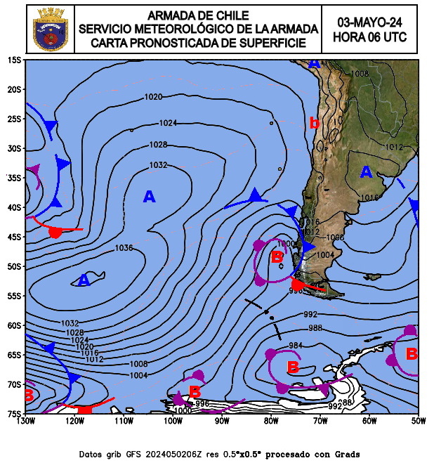
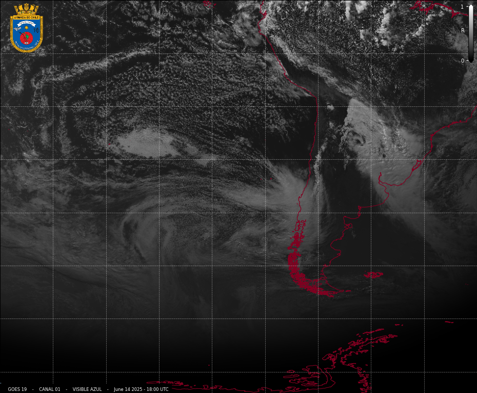
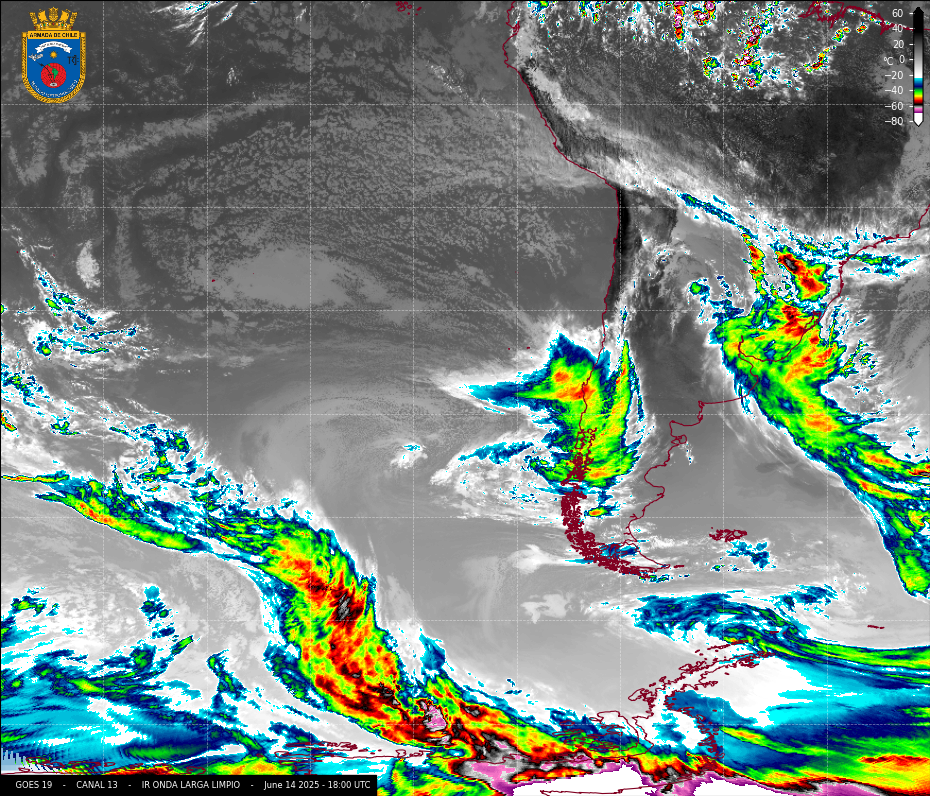
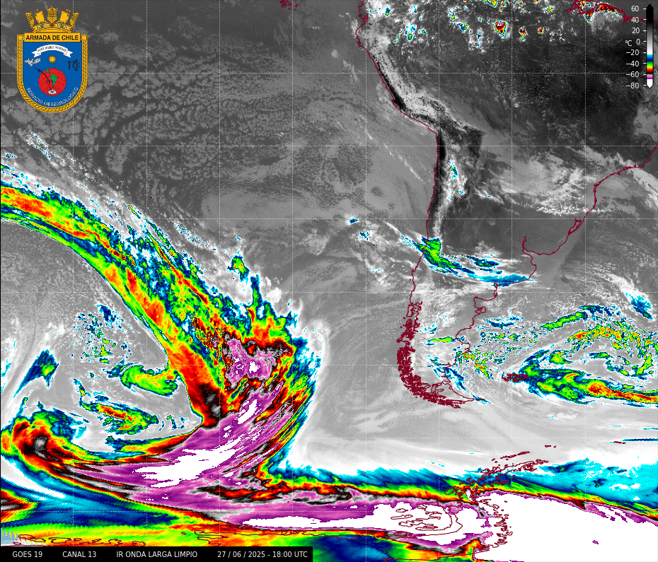
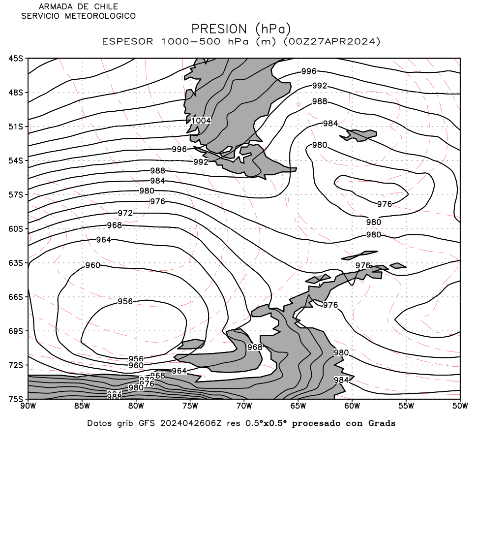
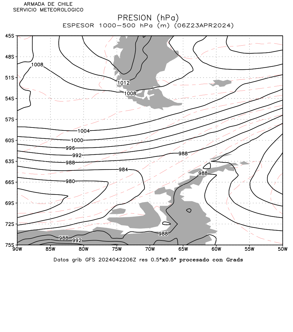
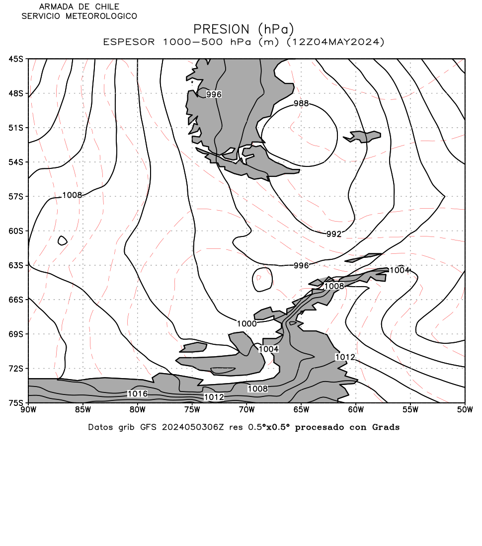
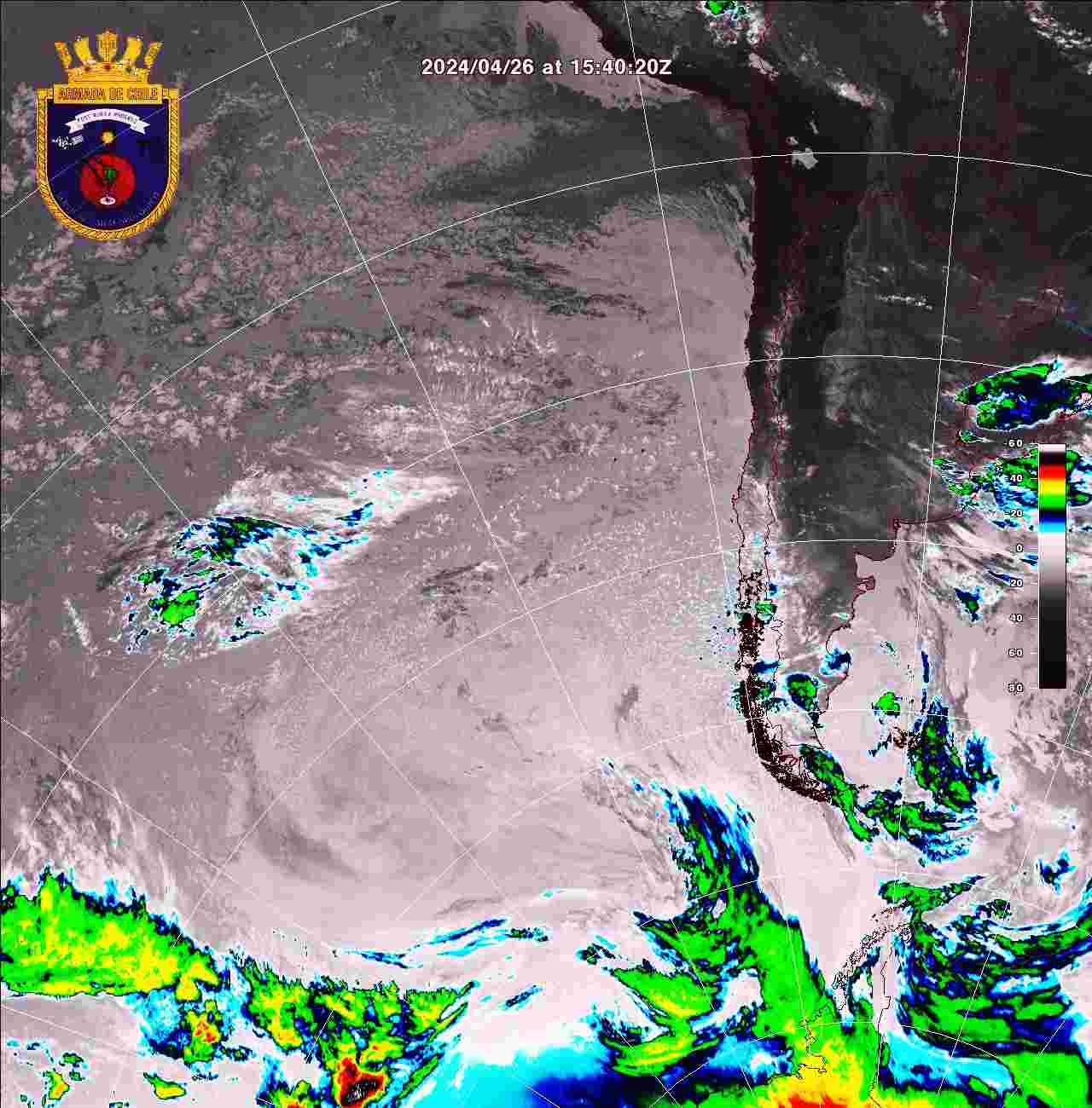
2.- Surface charts and satellite images
|
|
|
Arica to Longitude 76° West and Drake Passage to
Longitude 81° West |
Latitudes 18°20’ to 60° South and Longitudes 76°
& 81° to 120° West |
Latitude 60° to South Pole and Longitudes 53° to
120° West |
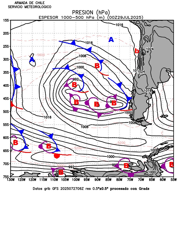
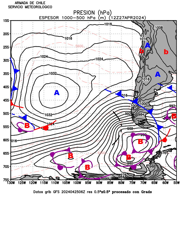
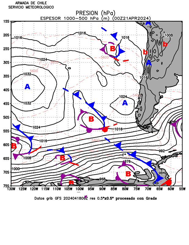
4.- Modelling outputs
from GFS (120 km), NWW3 (27 km), WRF (3 & 9 km)
|
RADIO FACSIMILE
BROADCAST |
12 |
24 |
36 |
48 |
60 |
72 |
GIF |
|
Surface - Eastern South Pacific |
● |
||||||
|
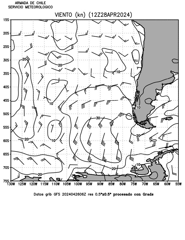
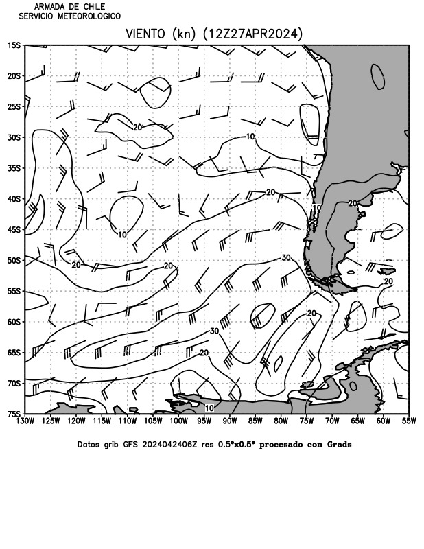
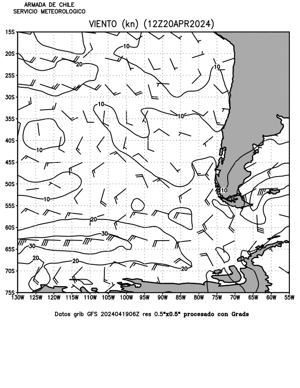
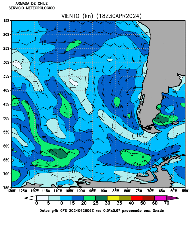
Winds
B&W Eastern South Pacific |
|||||||
|
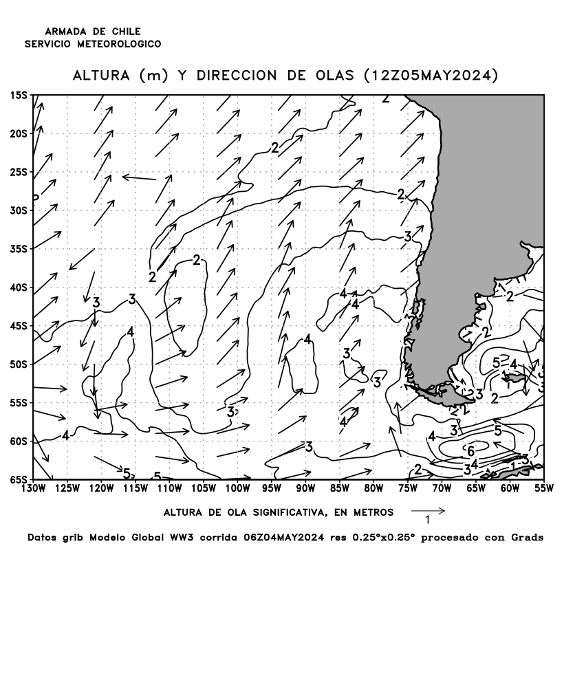
Waves
B&W Eastern South Pacific |
|
ATMOSPHERIC
PRESSURE |
120h |
GIF |
|
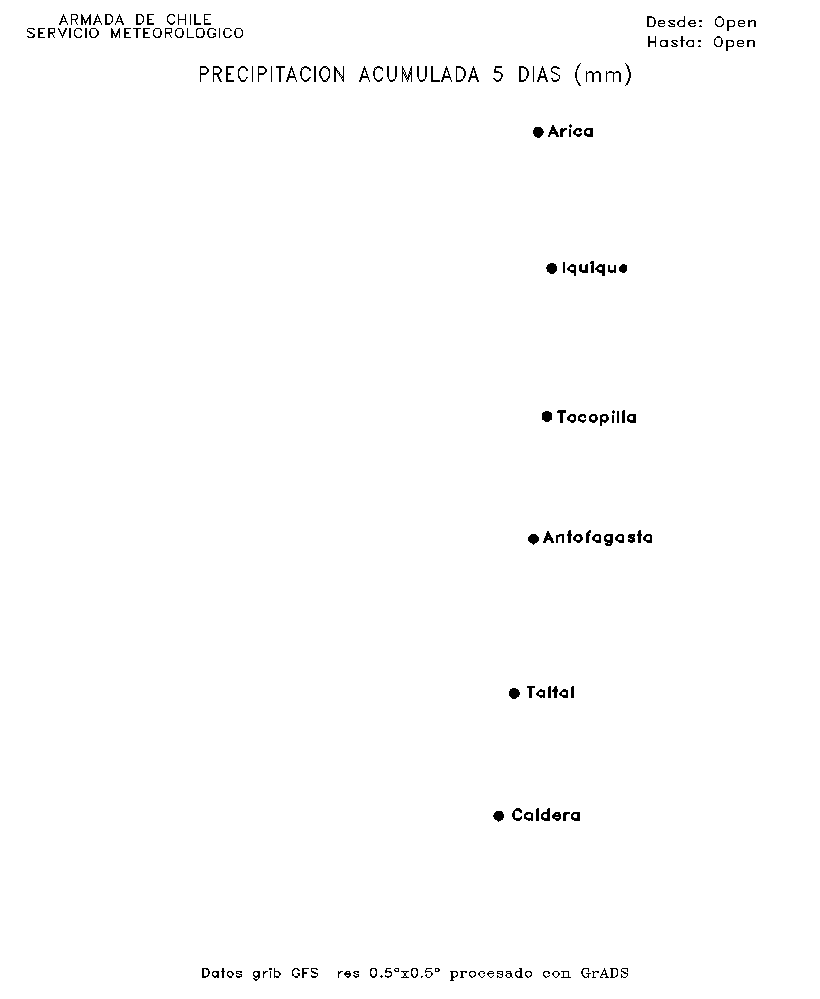
5 DAYS
ACCUMULATED RAIN |
120h |
|
||
|
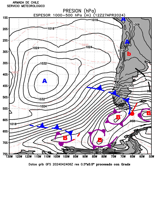
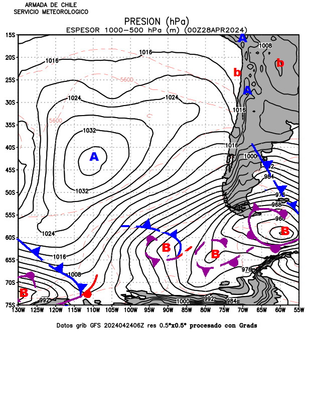
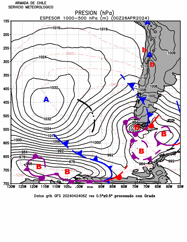
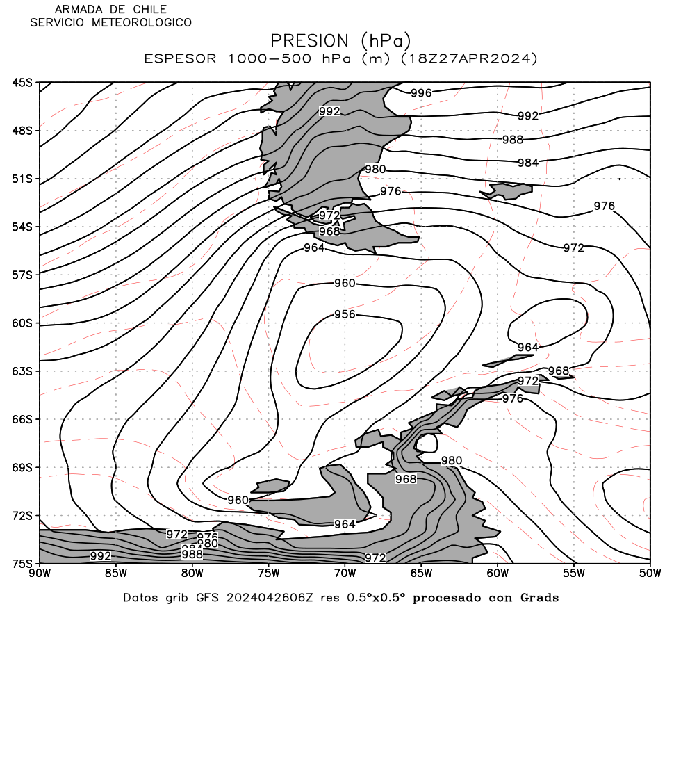
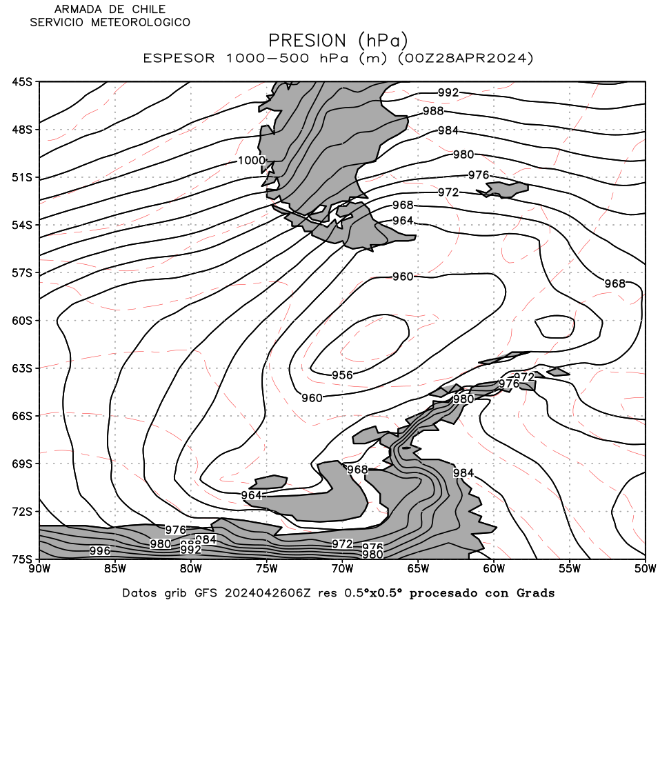
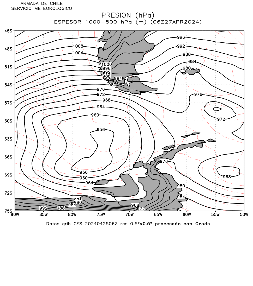
Thickness 1000-500 hPa |
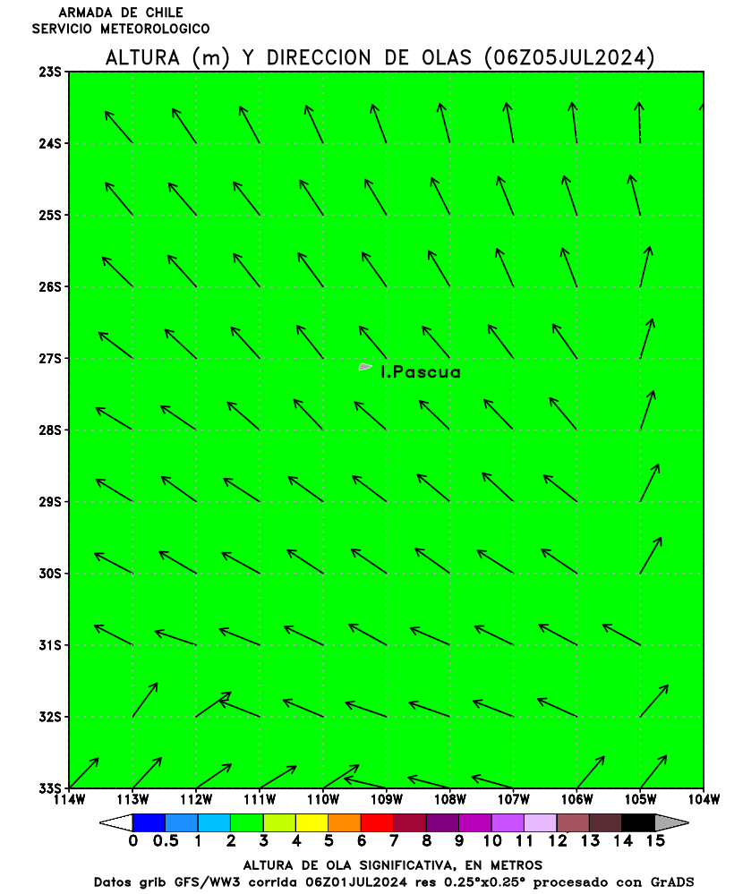
SIGNIFFICANT
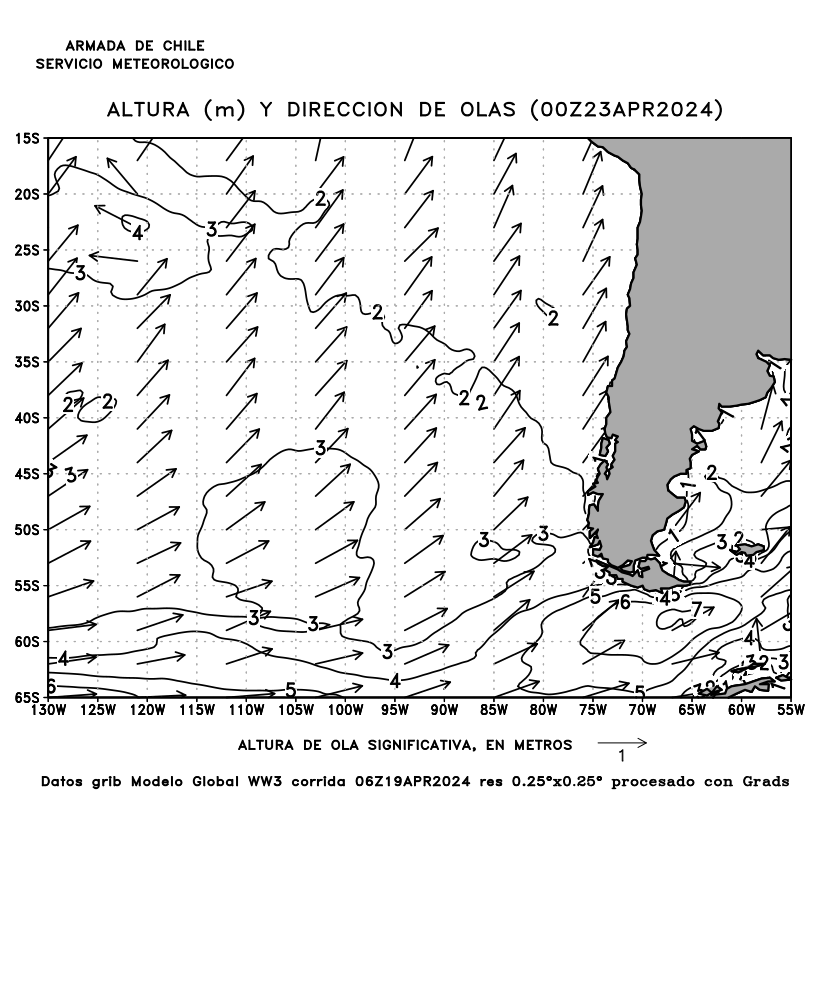
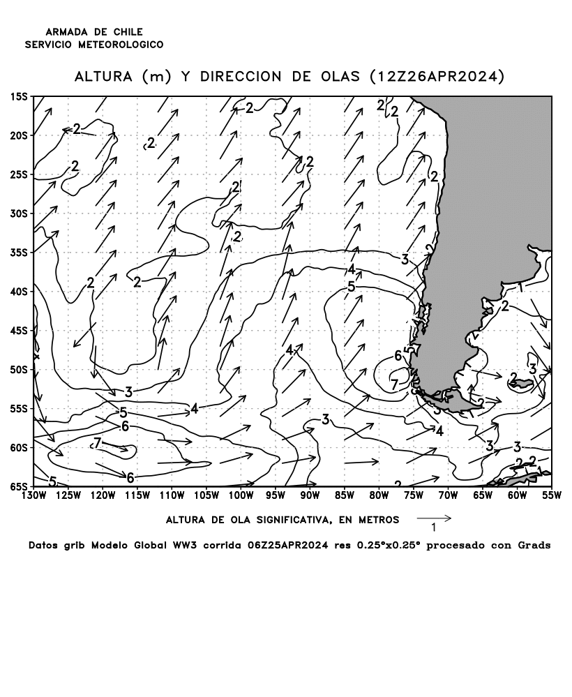
WAVE HEIGHT |
120h |
GIF |
Arica to Caldera |
||||
|
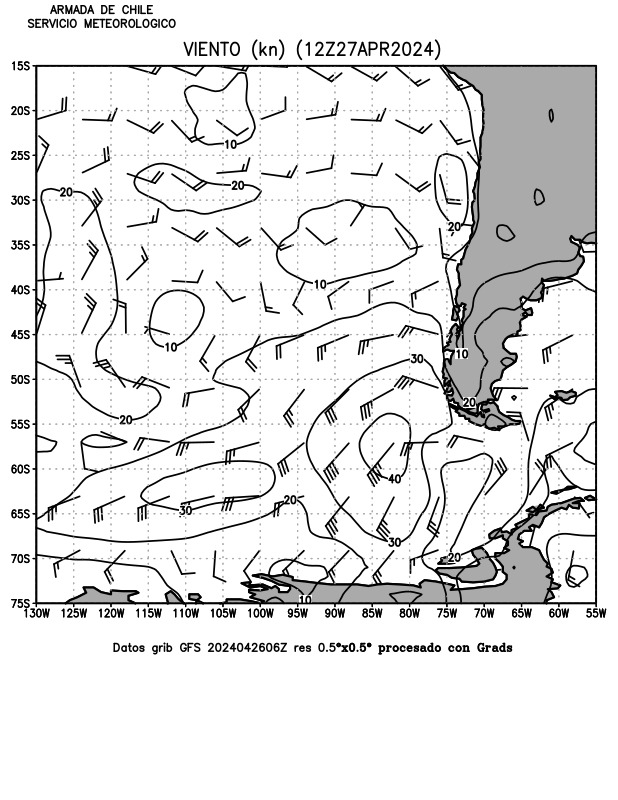
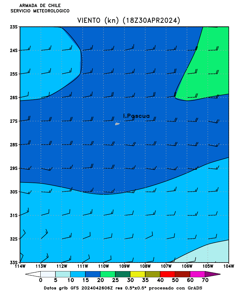
SURFACE WINDS |
120h |
GIF |
Periods and direction |
Huasco to Lebu |
||||
|
Eastern South Pacific |
Eastern South Pacific |
Lirquen a Quellon |
||||||
|
Eastern South Pacific +>35 Knots |
Eastern South Pacific +>5 meters |
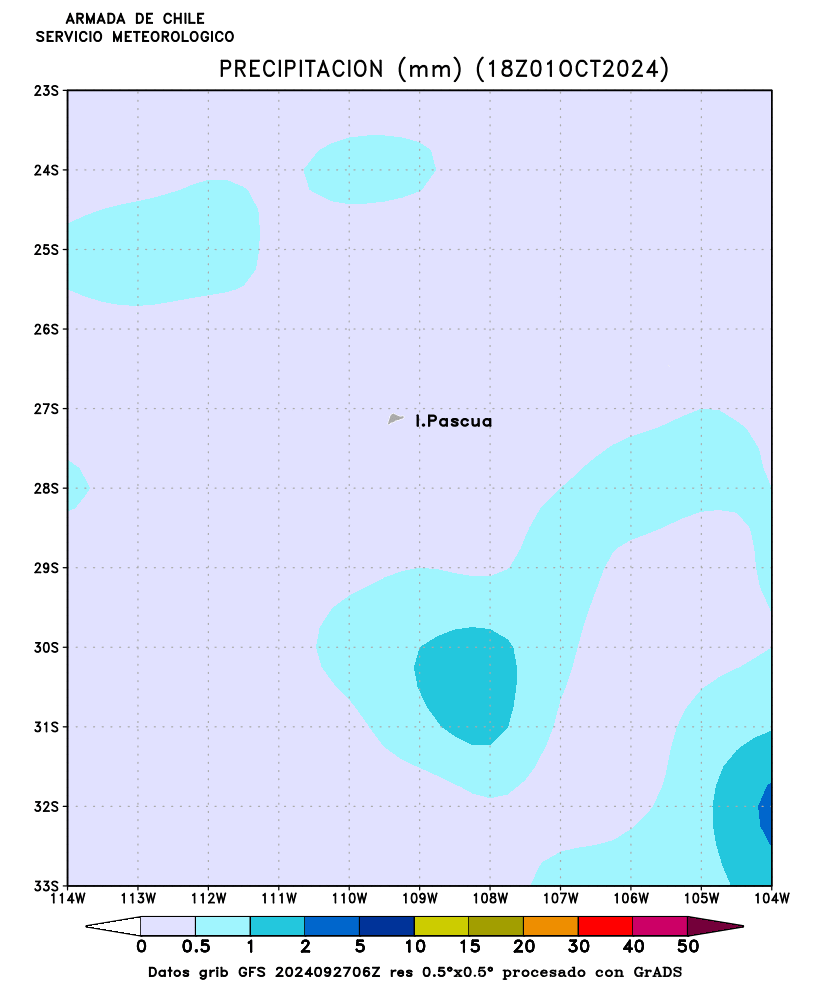
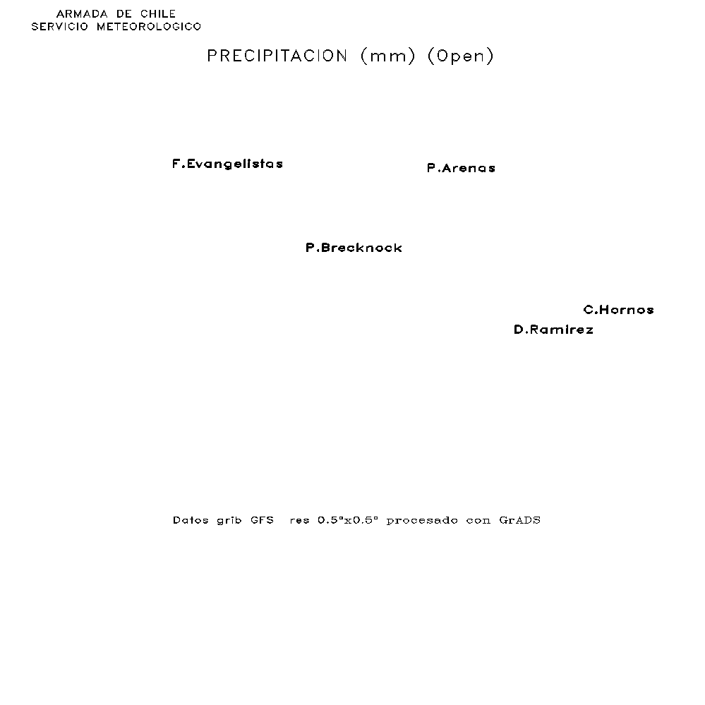
DAYLY
PRECIPITATIONS |
120h |
GIF |
||||
|
Easter Island |
Easter Island |
Easter Island |
||||||
|
Arica to Caldera |
Arica to Caldera |
Arica to Caldera |
||||||
|
Huasco to Lebu |
Huasco to Lebu |
Huasco to Lebu |
||||||
|
Lirquen to Quellon |
Lirquen to Quellon |
Lirquen to Quellon |
||||||
|
Calbuco to Trinity gulf |
Calbuco to Trinity gulf |
Calbuco to Trinity gulf |
||||||
|
Trinity
gulf to Latitude 60°South |
Trinity
gulf to Latitude 60°South |
Trinity
gulf to Latitude 60°South |
||||||
|
Drake passage |
Drake passage |
Drake passage |
||||||
5.- Meteorological Data
|
Aeronautical
and Synoptic Data (OGIMET) and FORECAST.CL charts |
|
Voluntary
observation ships and oceanic buoys |
6.- Floating Ice
|
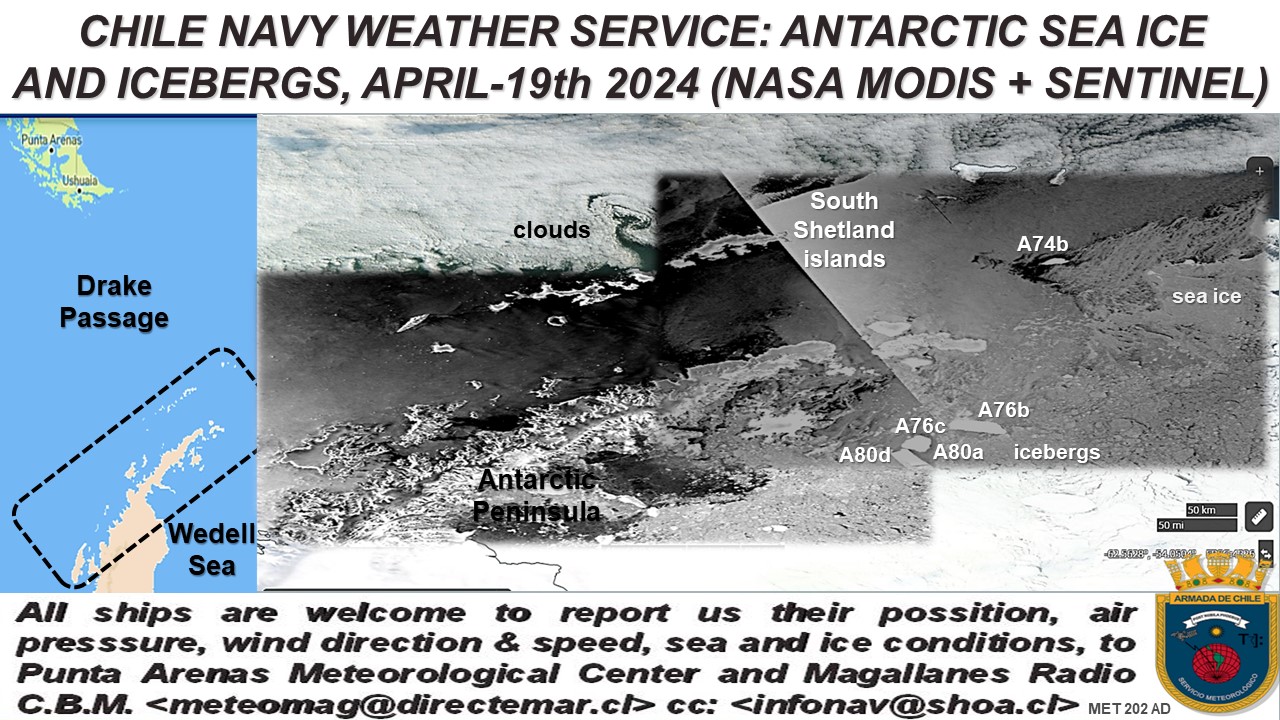
ANTARCTIC
ICEBERGS |
LOCAL REPORTS |
||
|
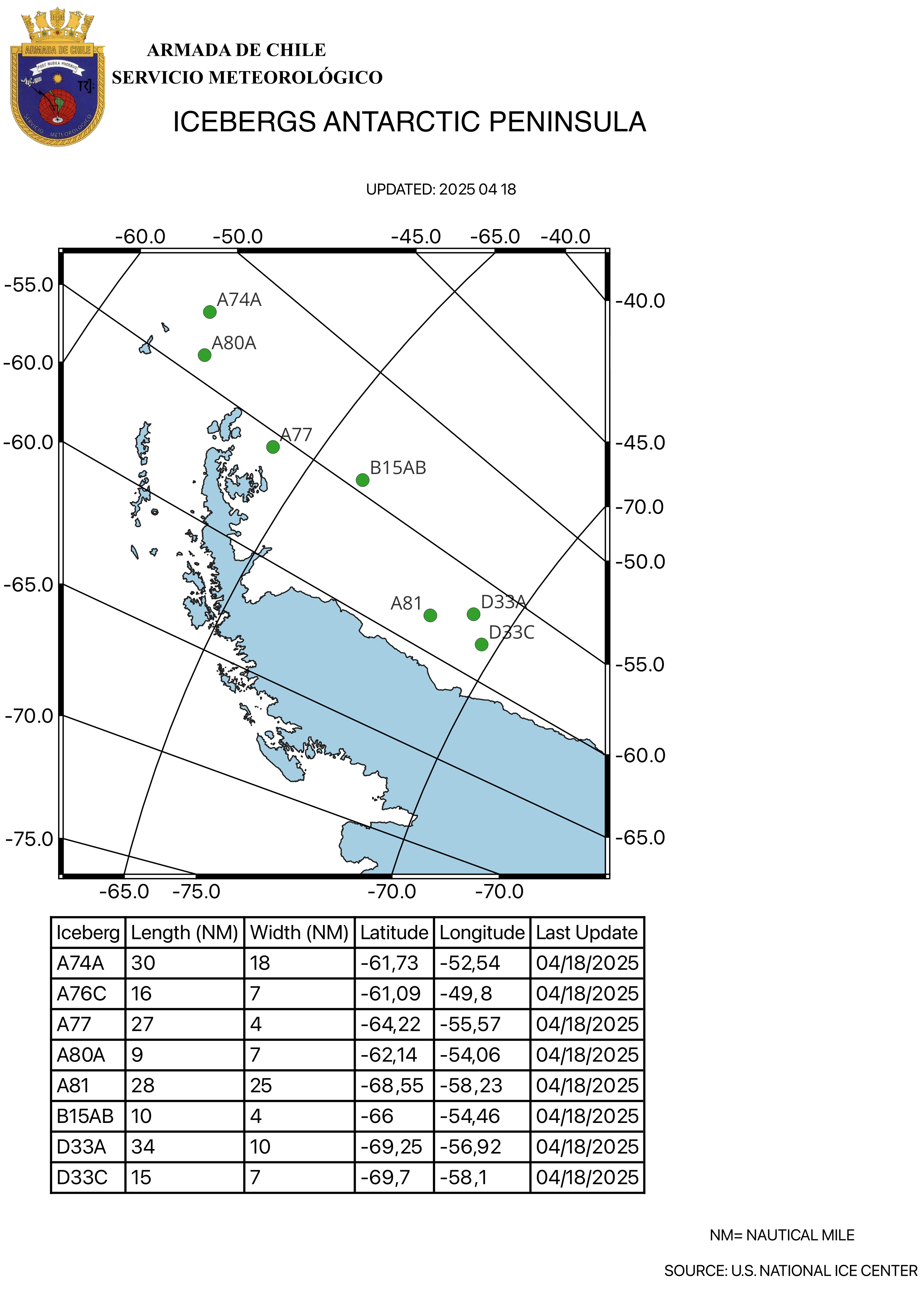
Antarctic
Peninsula Icebergs |
Chilean Antarctic Bases
|
||
|
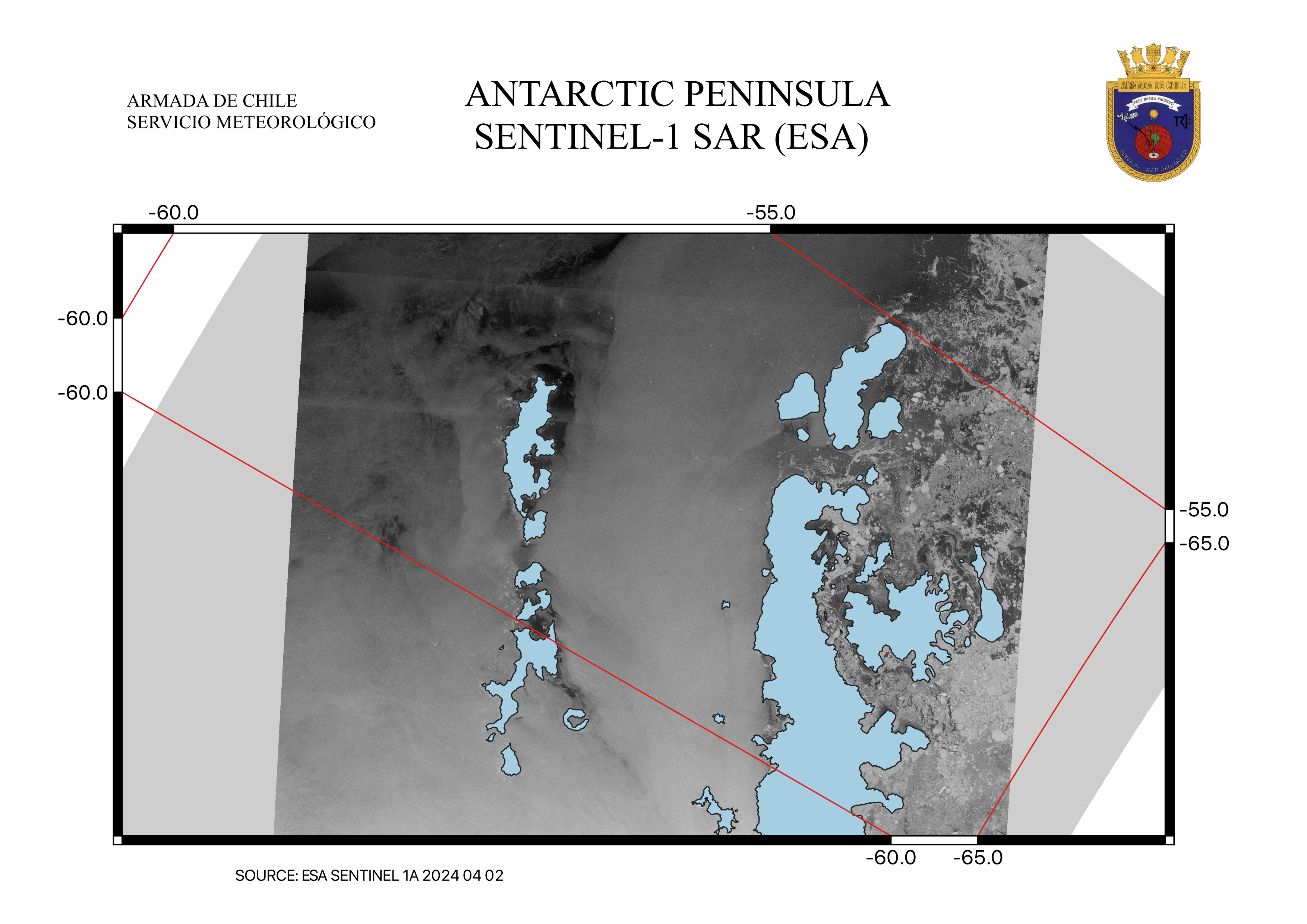
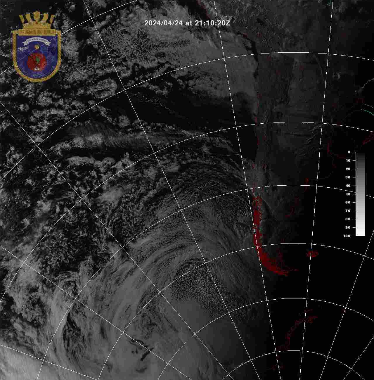
Antarctic
Peninsula Radar Images |
|||
|
Antarctic
Peninsula Satellite Mosaic |
NIC/BRU |
Chilean Antarctic Institute (INACH) |
|
|
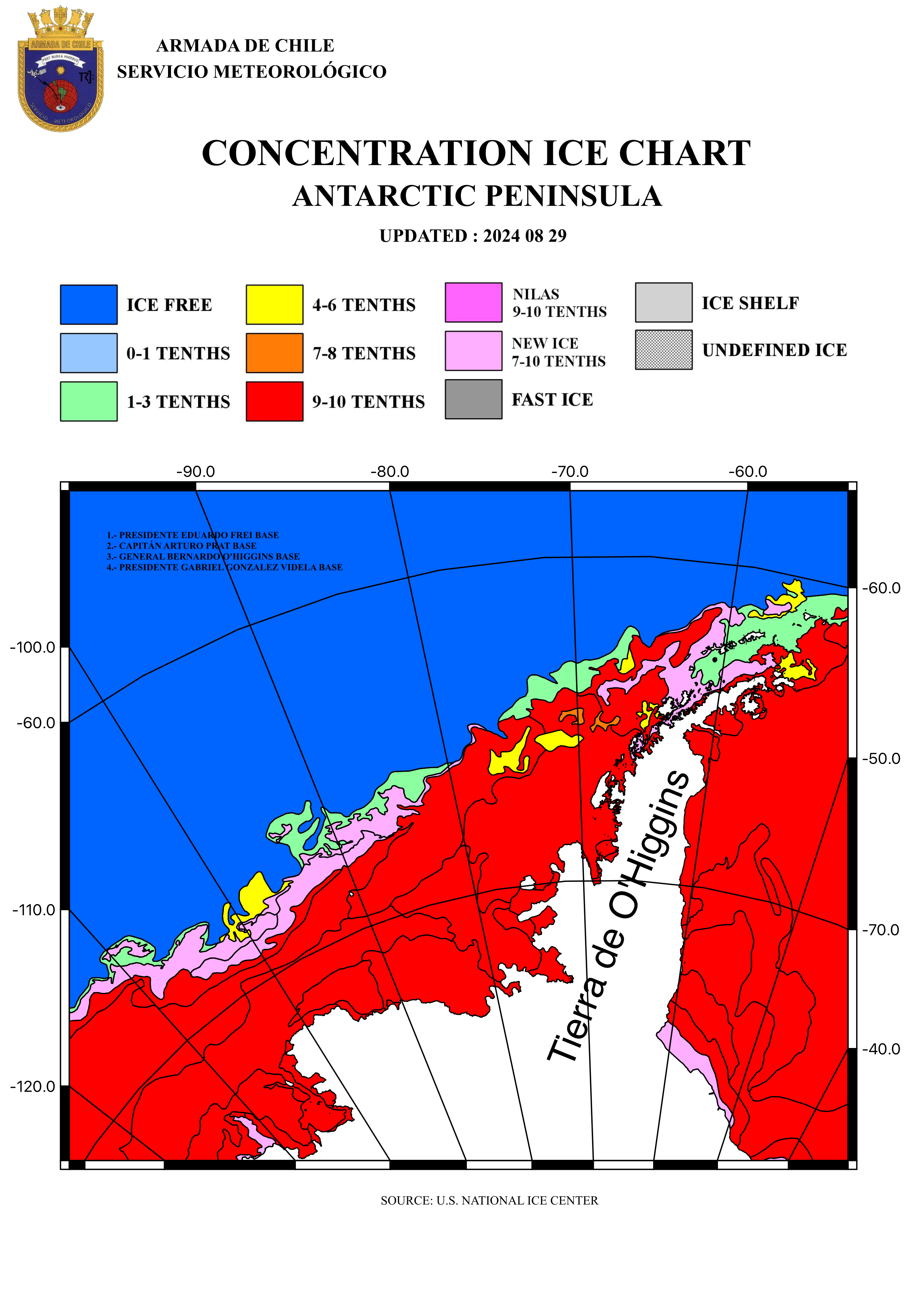
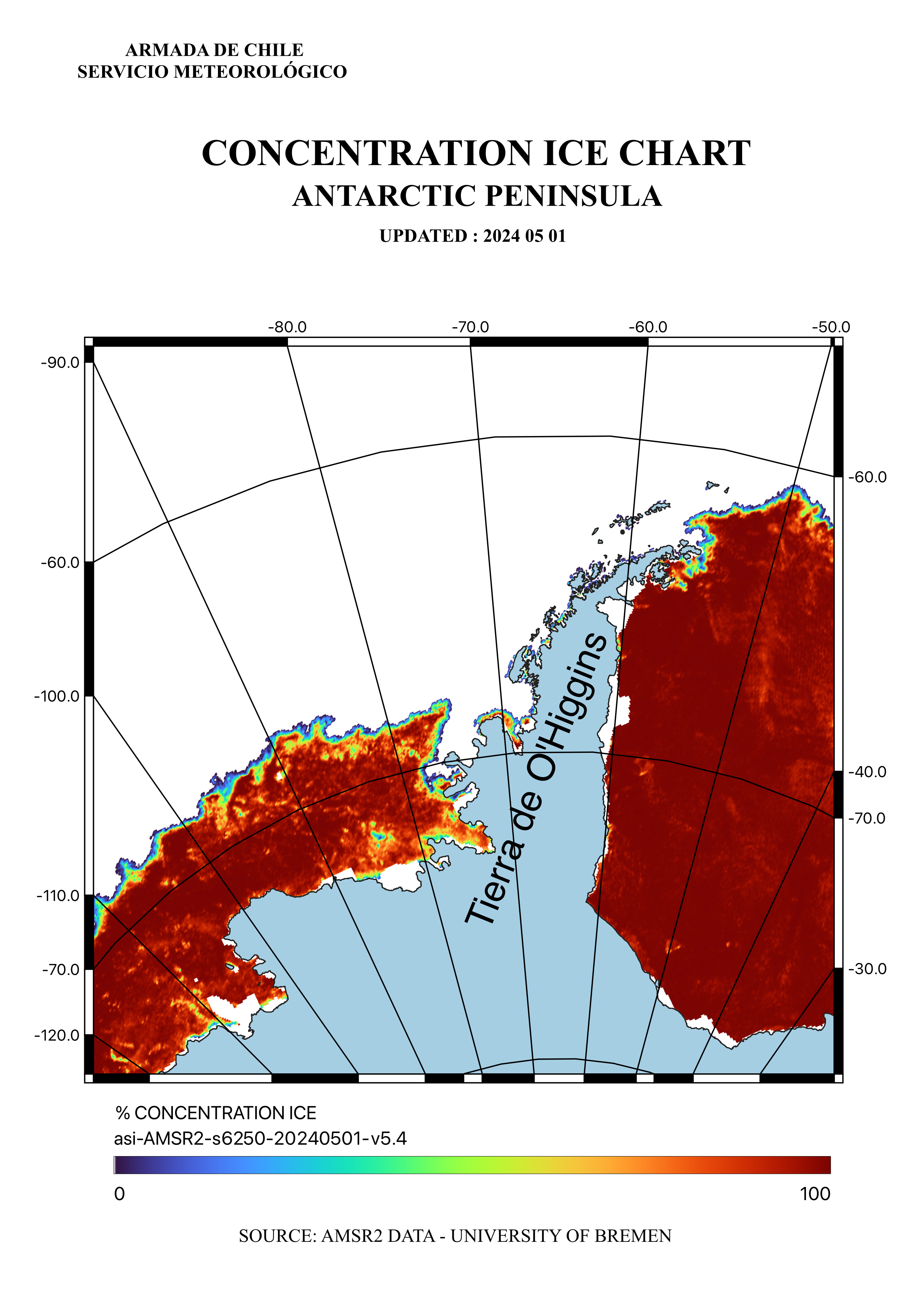
Antarctic
Peninsula Sea Ice Concentration |
|||
|
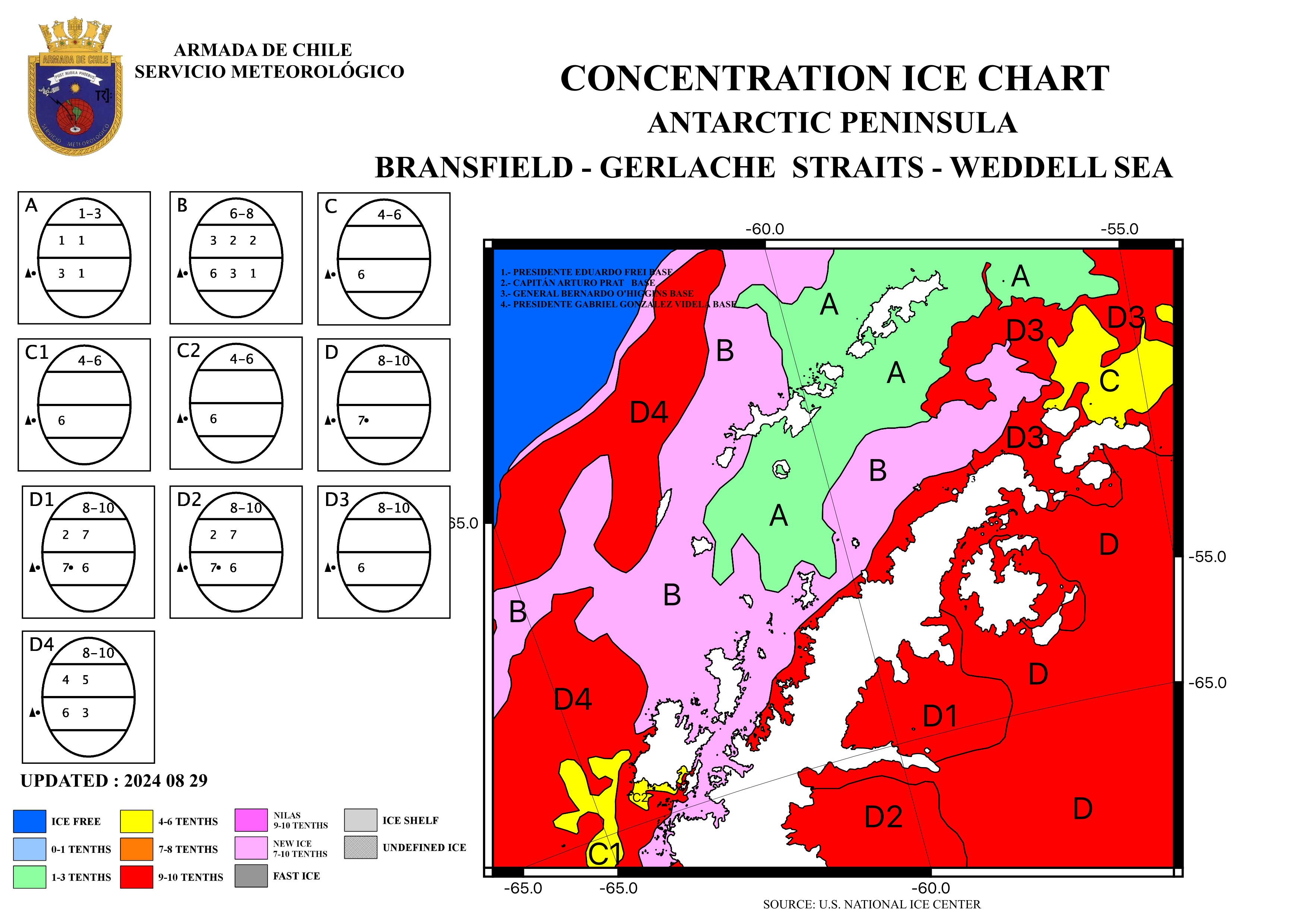
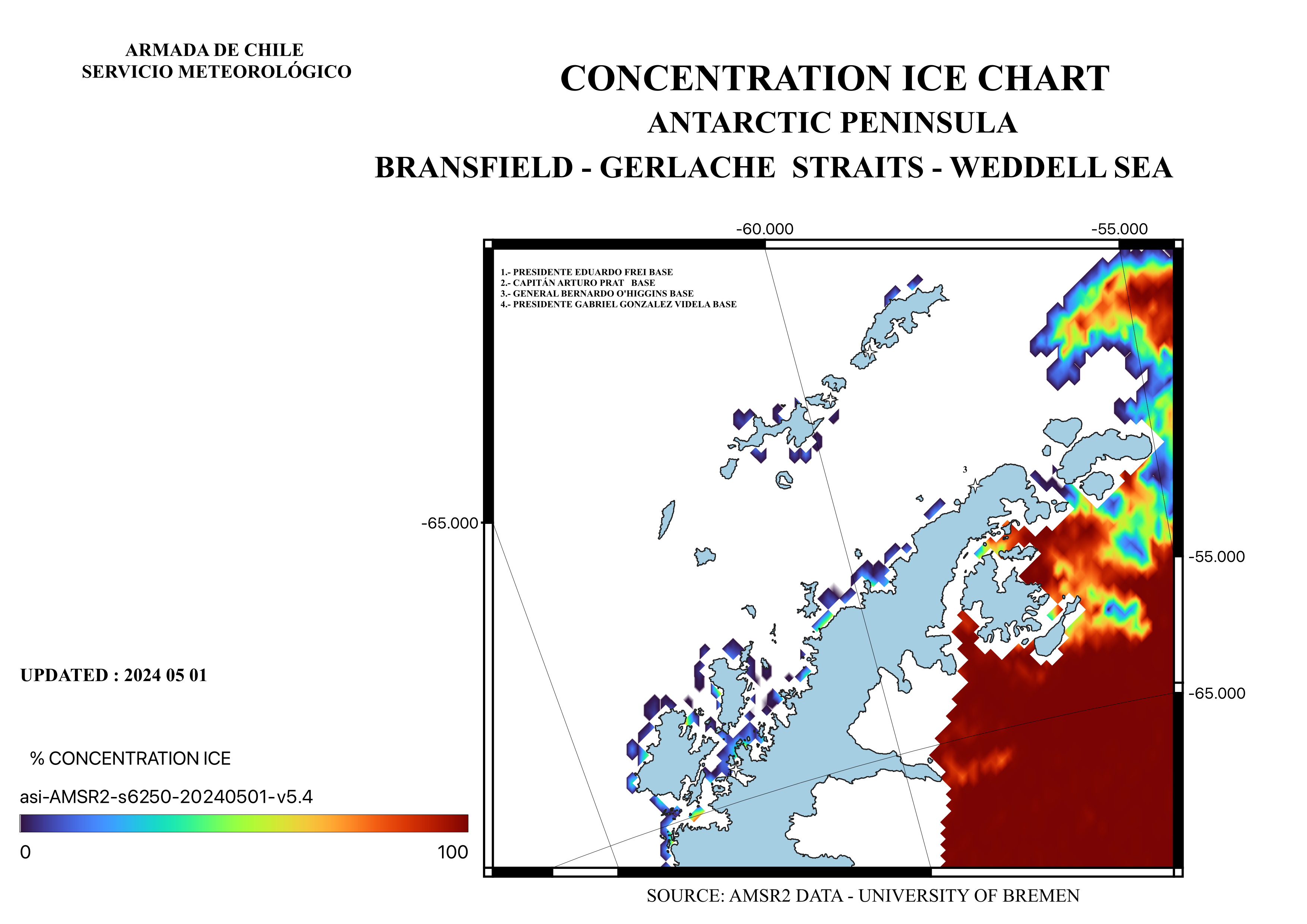
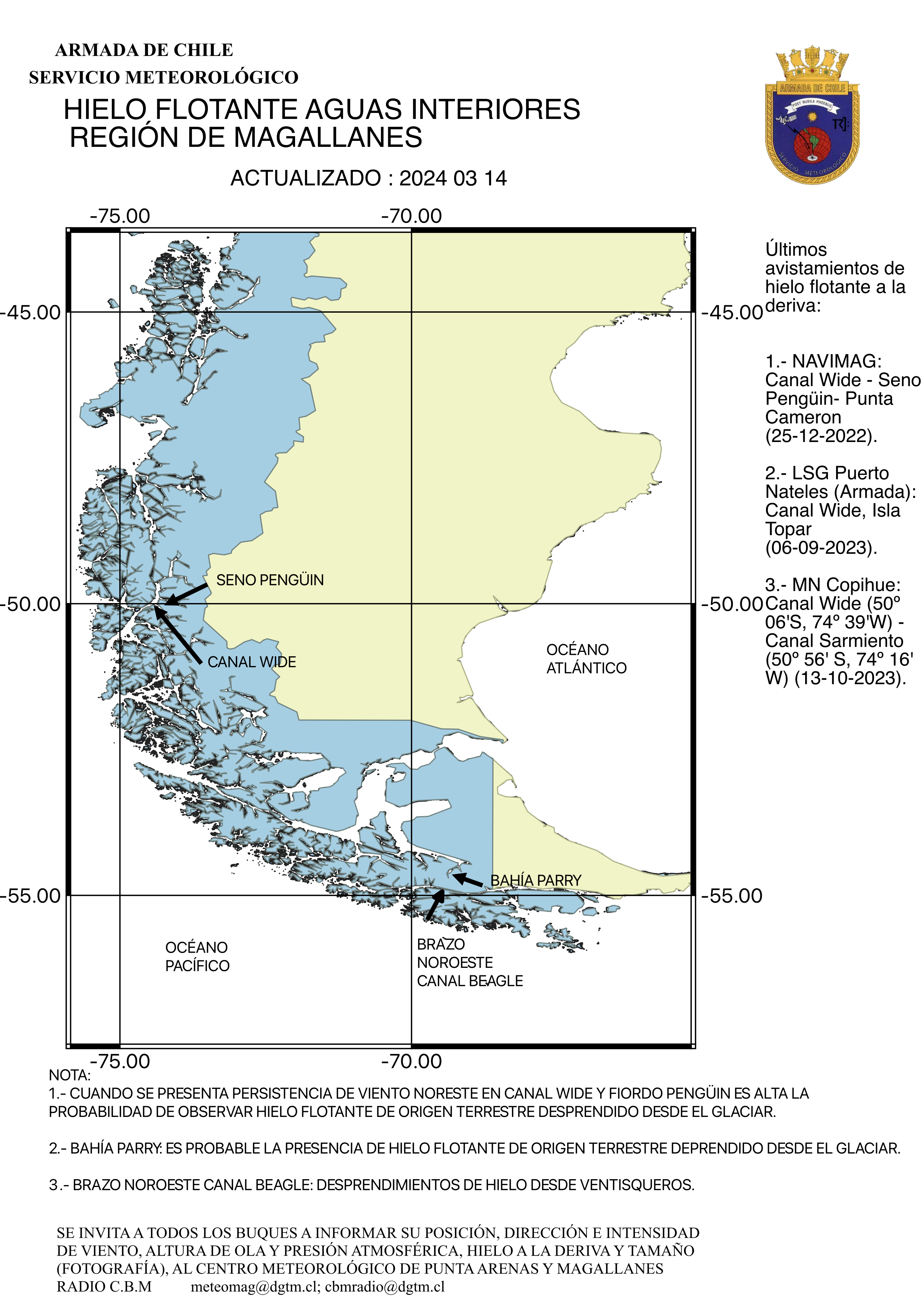
Bransfield Strait Concentration |
MAGELLAN
DISTRICT |
||
|
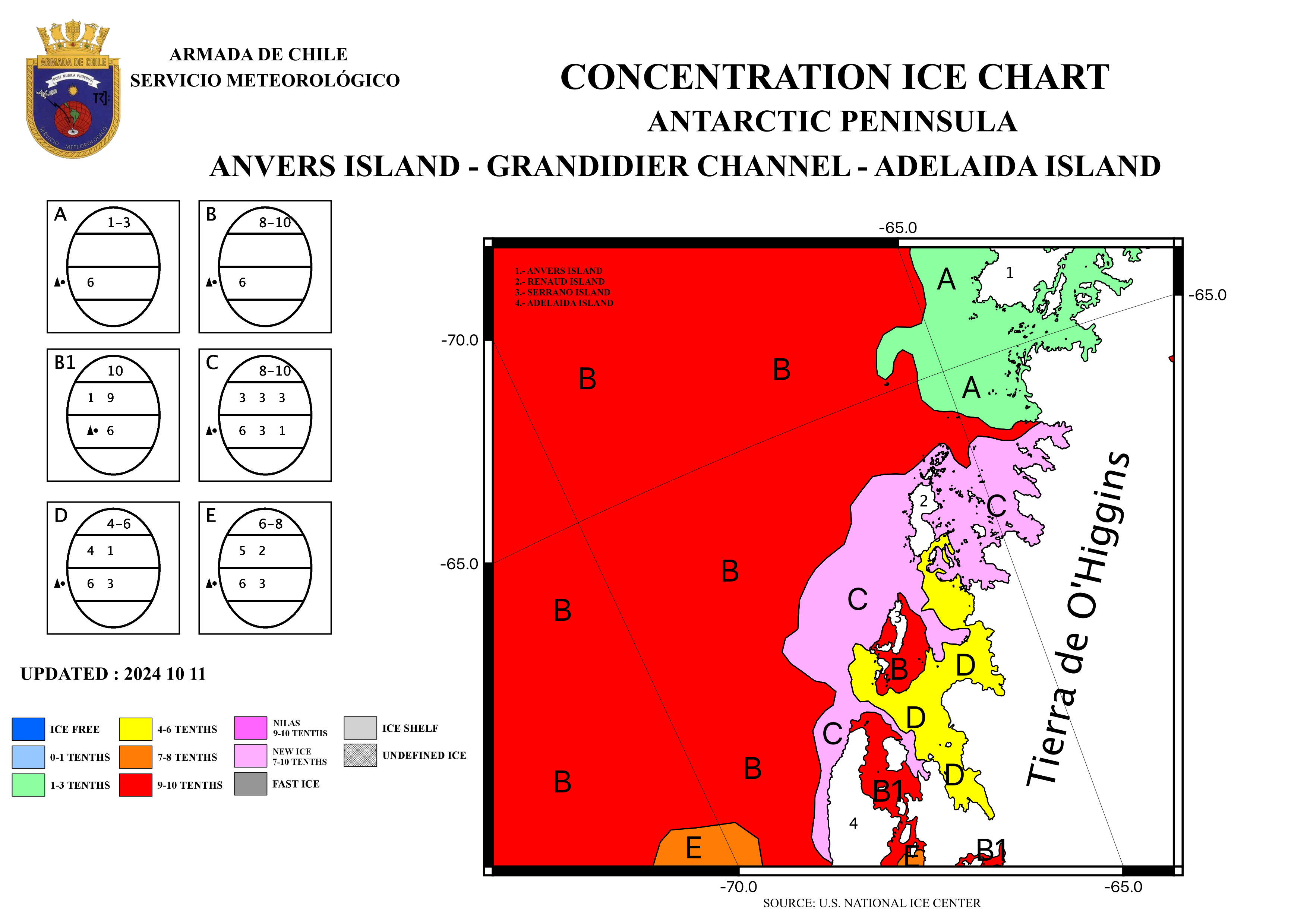
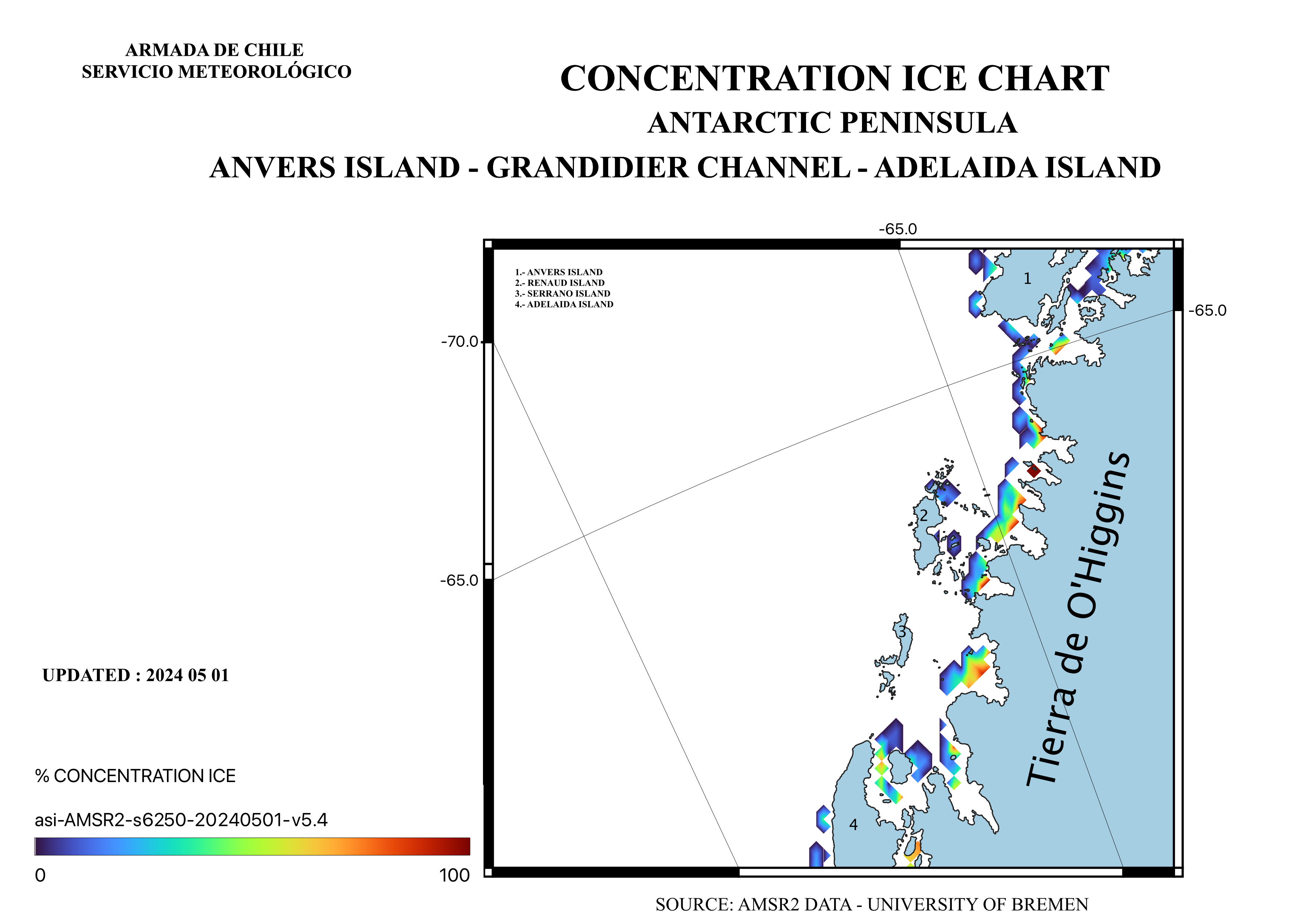
Anvers
Island Concentration |
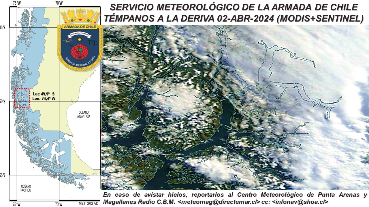
Patagonian Fjords Map |
||
|
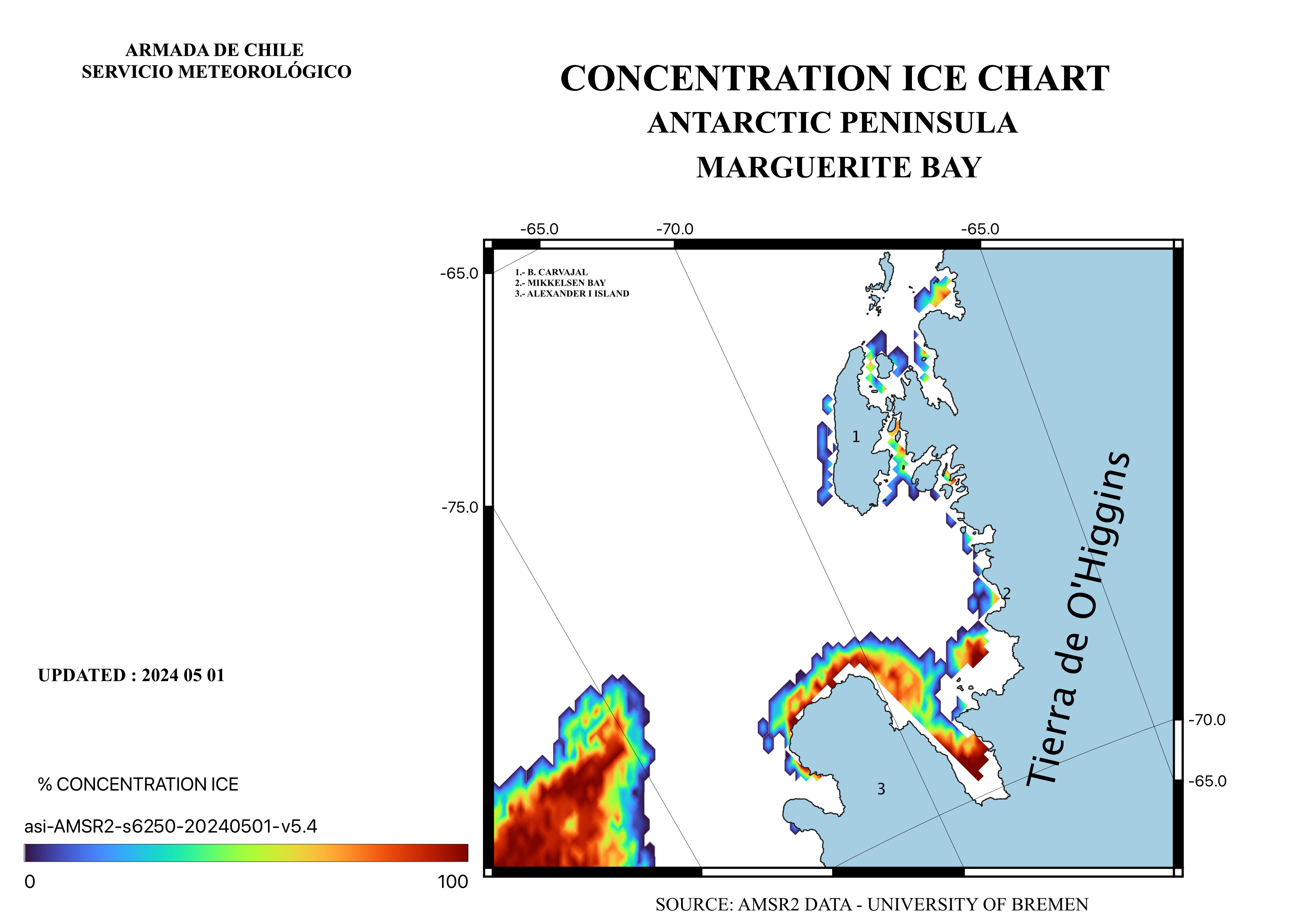
Margerite Bay Concentration |
Patagonian Fjords Mosaic |
||
|
Antarctic
Pass and Weddell Sea |
|
||
|
Polar View sea ice limits charts and
synthetic aperture radar (Sentinel) in three days mosaics
and Advanced Microwaves Scanning Radiometry (AMSR) images for marine icebergs detection |
|||
|
NASA satellite images web
based interactive TERRA-AQUA-NPP-VIIRS and GOES infra-red NOAA mosaics covering World Wide, Hemispheric, South Pole and Antarctic Peninsula,
from Europe Space Agency (ESA) and its Sentinel constellation |
|||
|
Antarctic Mesoscale Prediction
System (AMPS)
National Science Foundation (NSF) backup |
|||
_.- Antarctic Informations (for fast download)
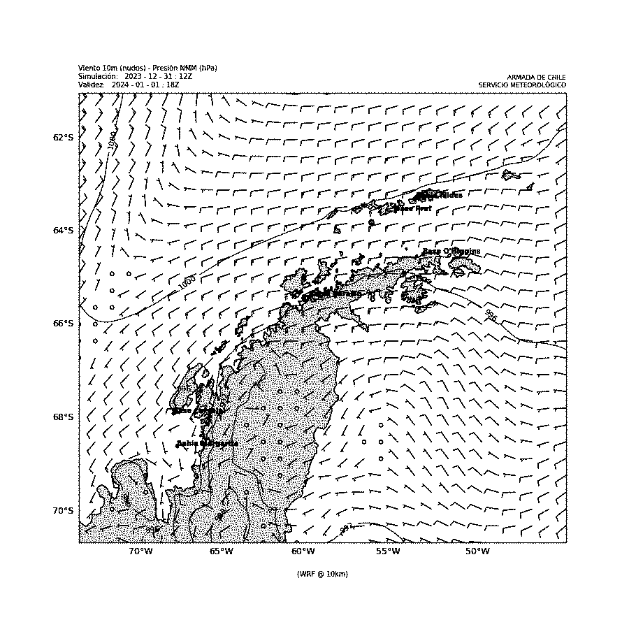
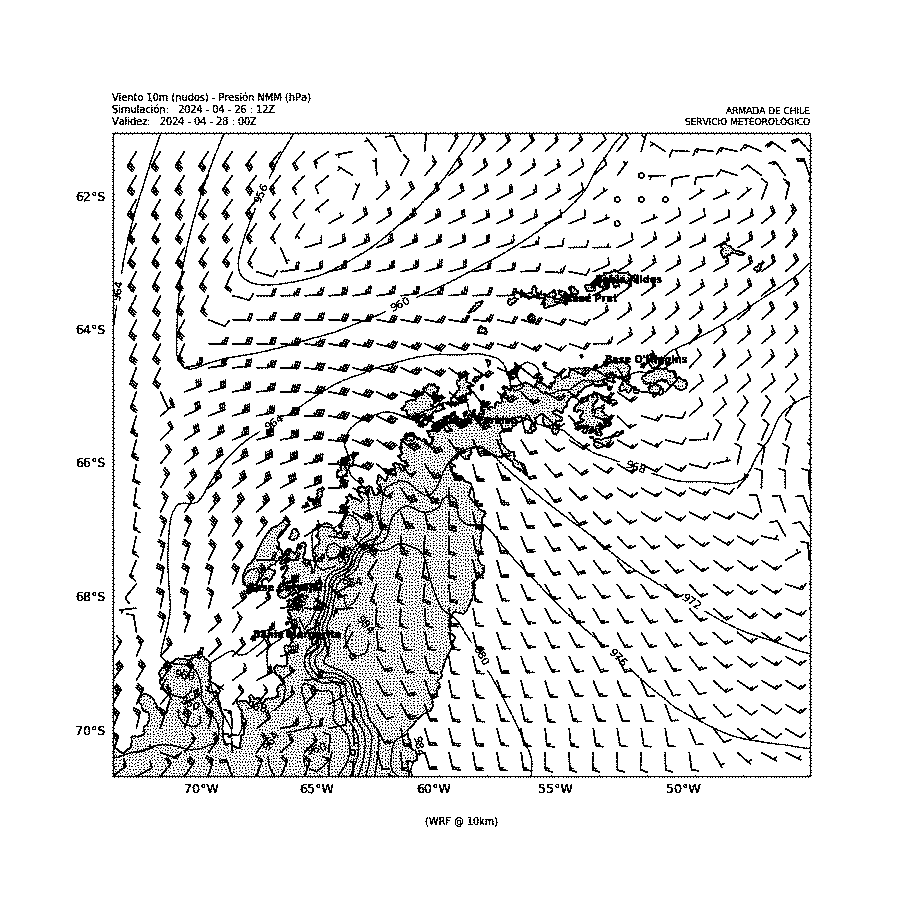
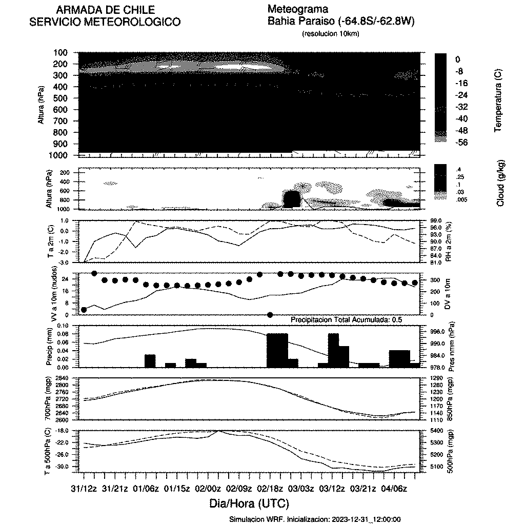
|
CHARTS AND IMAGES |
METGRAMS |
MODELLING |
12H |
18H |
24H |
30H |
36H |
42H |
48H |
||
|
Thickness 1000-500 hPa |
|||||||||||
|
Wind and Pressure |
|||||||||||
|
Waves Drake Passage |
|||||||||||
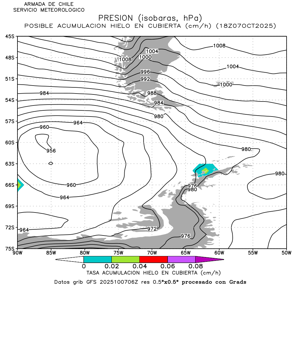
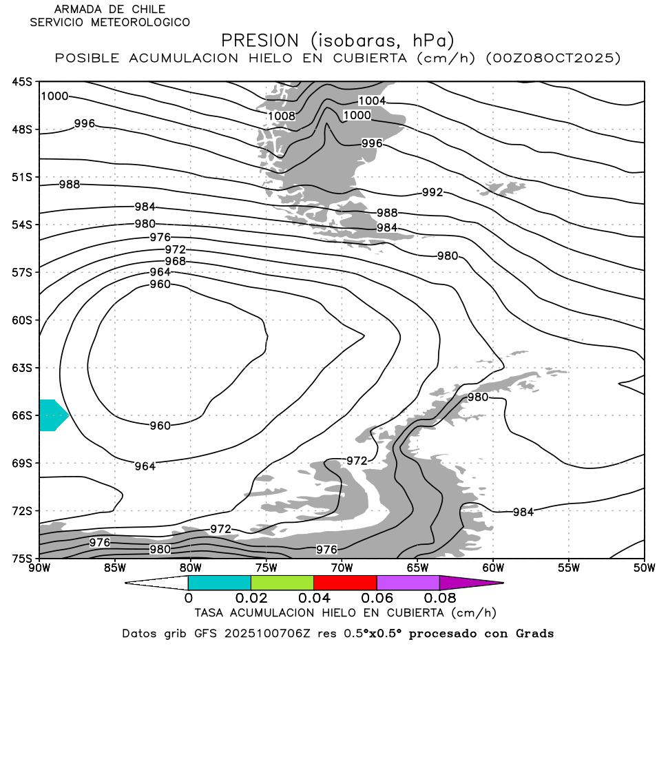
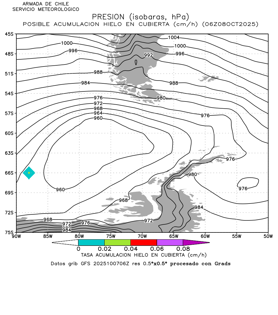
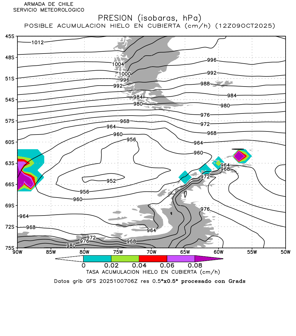
|
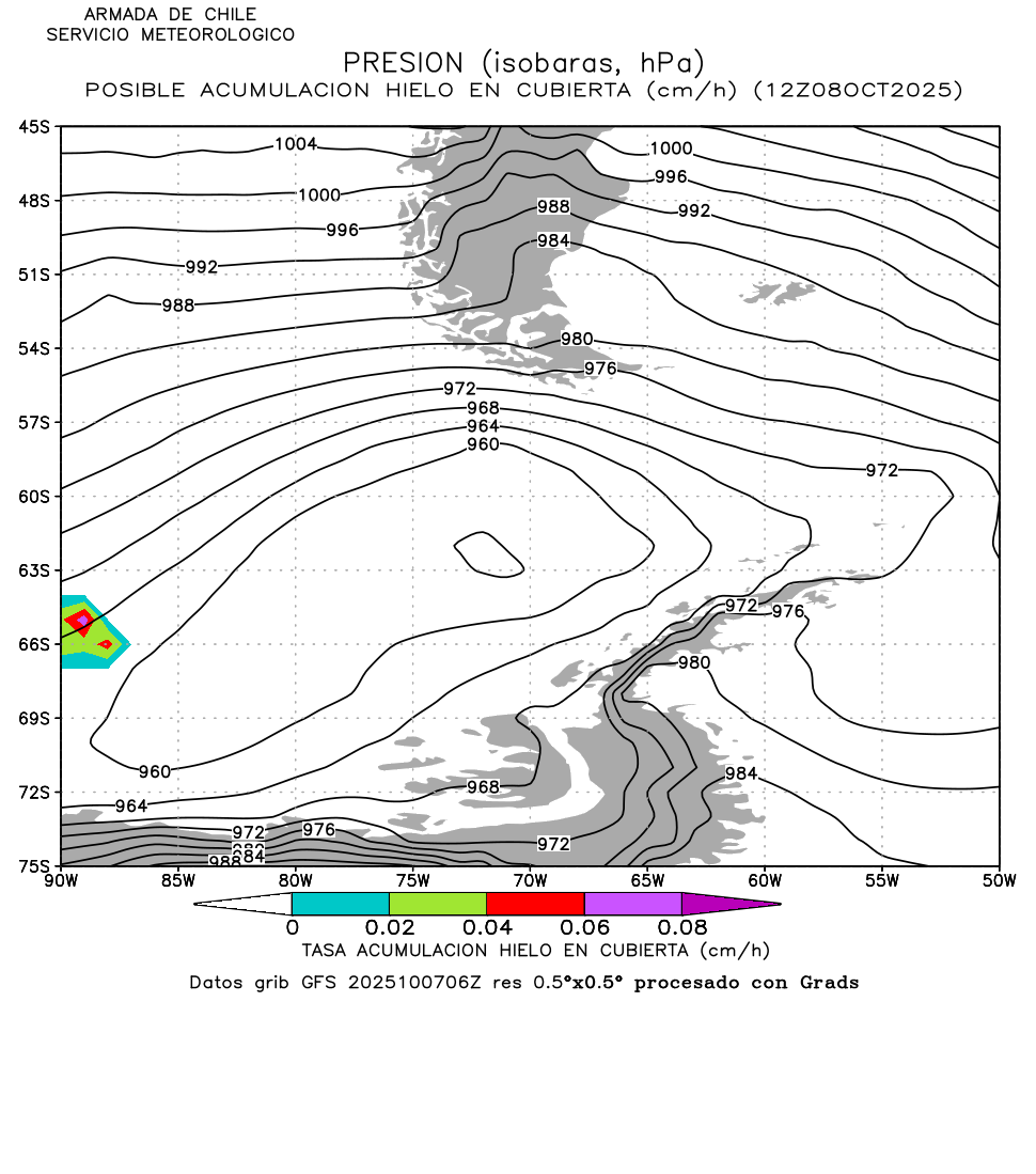
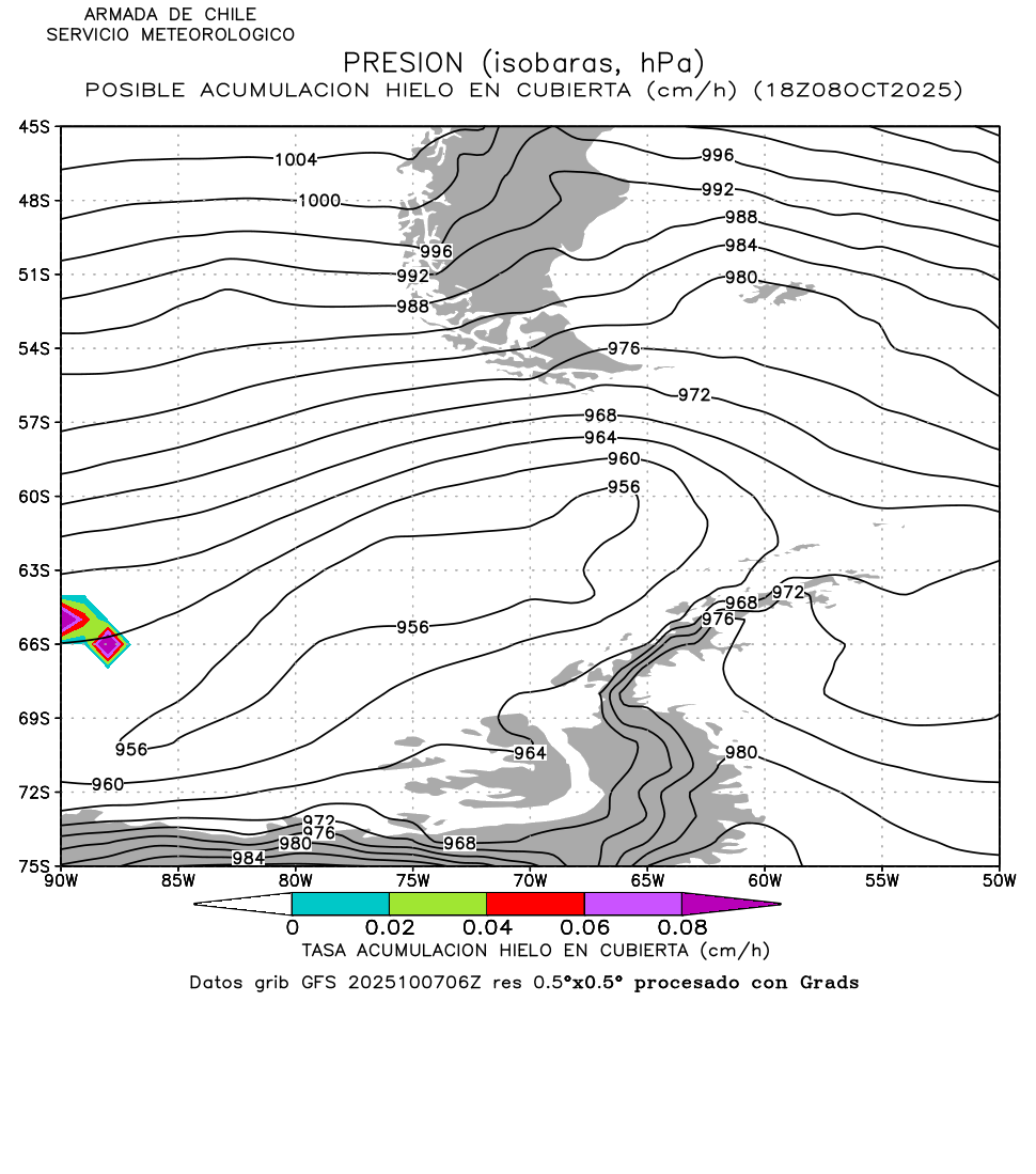
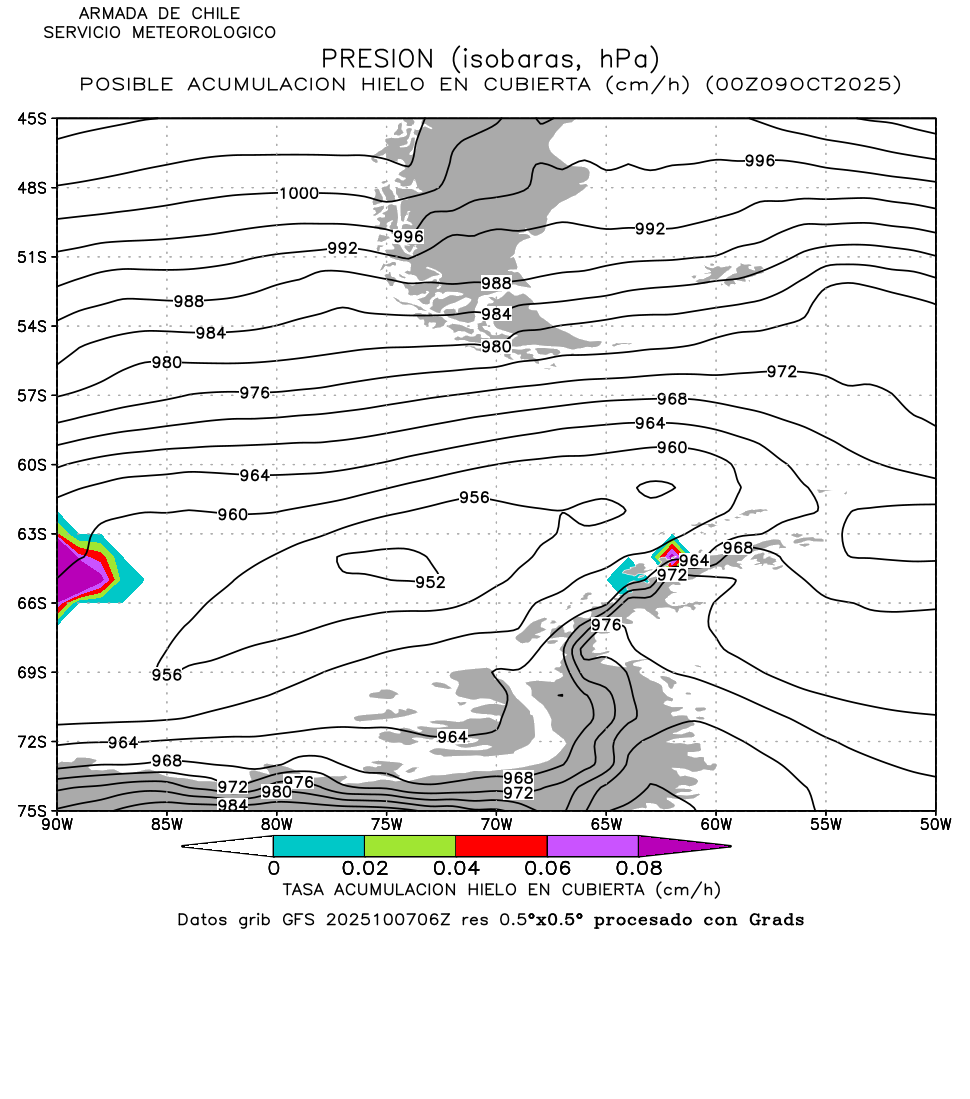
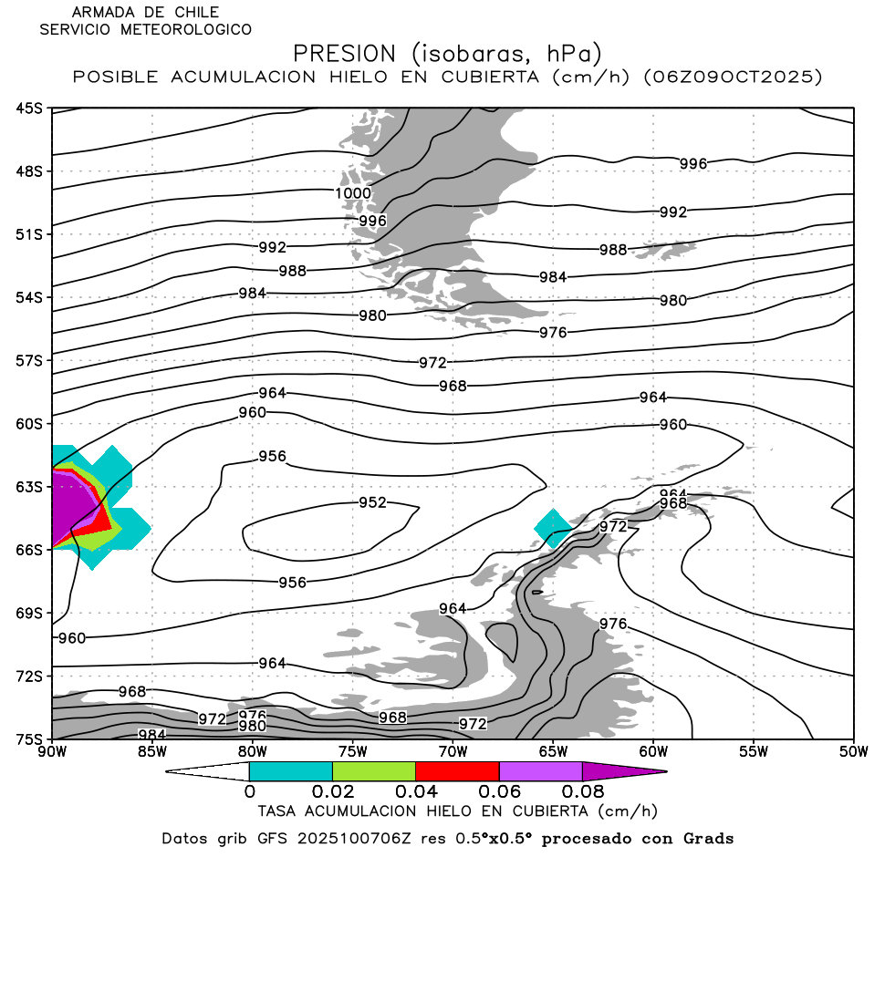
Possible Ice Accretion over
decks on board the vessels |
06h |
||||||||||
7.- Contact
|
FOLLOW US ON TWITTER : Chile Navy Weather Service and Meteorological Centres of Iquique, Valparaíso, Talcahuano, Puerto Montt and Punta Arenas |
|
Comments
and suggestions : servimet@directemar.cl |
|
Links to the WMO & IHO surveys on Maritime
Safety Information, marine meteorology, communications, navigation warnings,
sea ice services and voluntary ships. |
8.- External links
|
World Meteorological Organization (WMO) Advisory Group
on the Worldwide Met-Ocean Information and Warning Services Sub-Committee (AG.WWMIWS.Sub-C)
for the international marine weather
information coordinators. |
|
Chile Air Force Meteorological Directorate (DMC): aeronautics, civilian and numerical WRF forecasts with UV radiation indexes,
General Directorate of Civilian Aeronautics (DGAC): on-line runway webcams |
|
Chile Navy Hydrographic & Oceanographic Service
(SHOA): coastal tides table and
gauges, daylight schedules and thematic charts for marine ice, waves and
clouds. |
|
Sea
Level Station Monitoring Facility by the Intergovernmental Oceanographic
Committee (IOC) |
|
Chile National Disaster Risk Reduction and Response
Service (SENAPRED) of the Homeland
Ministry and Public Security (ex-ONEMI) |
|
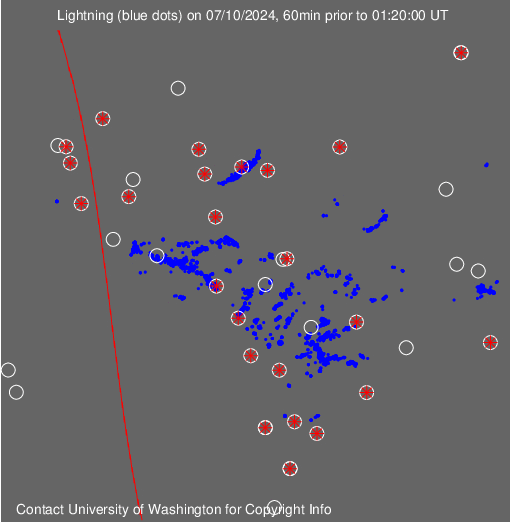
World Wide Lightning Location Network (from Washington and Valparaiso universities), Morphed
Integrated Microwave Imagery of Total Precipitable
Water (by Wisconsin university) |
|
Advanced Studies Center for Arid Zones (CEAZA): automatic weather
stations and forecasts for Coquimbo |
|
Institute for Fisheries Development (IFOP): automatic weather
stations for Climate
Change Monitoring and Oceanographic Information System (CHONOS) |
|
Worldwide Marine Traffic Automatic Identification
System (AIS), webcams on board cruise
ships, Rothera (UK) and Palmer (US) Antarctic Bases |
|
Morphed Integrated Microwave Imagery at CIMSS Total Precipitable
Water (MIMIC-TPW) |
|
Wetter Zentrale, Passage
Weather, MeteoBlue, ARL Ready NOAA, web pages
showing results from Weather Research Forecast and Global Forecast System Earth Null School, Ventusky, WindyTv, Windfinder to 7-14 days and trial coupled forecast (CFS)
for 30-90 days Weather On Line |
|
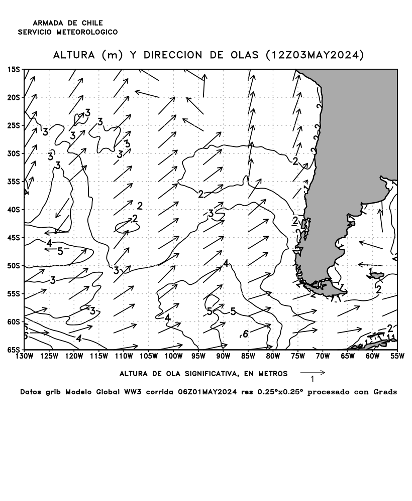
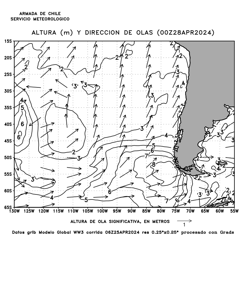
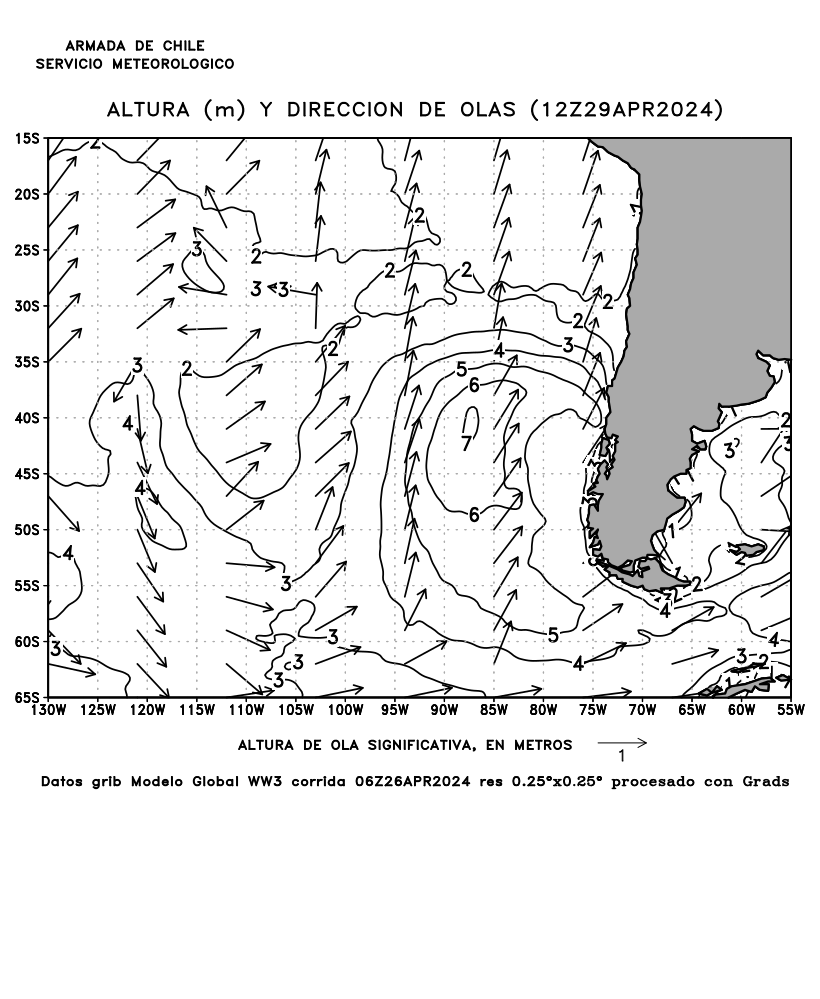
NWW3
numerical model for significant sea height, period, wind direction &
speed |
|
Japan Meteorological Agency (JMA) – Australian Government
Bureau of Meteorology (BOM) – New Zealand
Meteorological Service (MetService) |
|
Brazil Marine Meteorological Service Navy
Hydrographic Center (DHN.BR) Space Research Institute (CPTEC.INPE) Weather Prediction Center for Antarctic information and UV radiation |
|
Argentina National Weather Service (SMN) and Naval Hydrographic
Service (SHNA) - Ecuador Navy
Oceanographic and Antarctic Institute (INOCAR) - Peru Navy Hydrography
and Navigation Department (DHN.PE) |
MET 202 AD
13-XII-2022